Franklin County GPS Numbers
GPS Coordinates >Panhandle > Franklin
 Franklin County is called the Forgotten Coast due to it's natural beauty.
Apalachicola Bay
area has ports in Apalachicola, Carrabelle, and East Point.
Fishing inshore in Apalachicola Bay and around St. George Island or Dog Island can be productive fishing. If you venture offshore there is an abundance of shipwrecks, natural and artificial reefs where you catch the big fish! Check neighboring Gulf and Wakulla counties for more GPS Coordinates.
 ![]() Northwest Reefs & Shipwrecks
Northwest Reefs & Shipwrecks
GPS Numbers File Downloads
![]() PDF
PDF ![]() KML
KML ![]() GPX
GPX
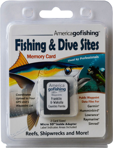
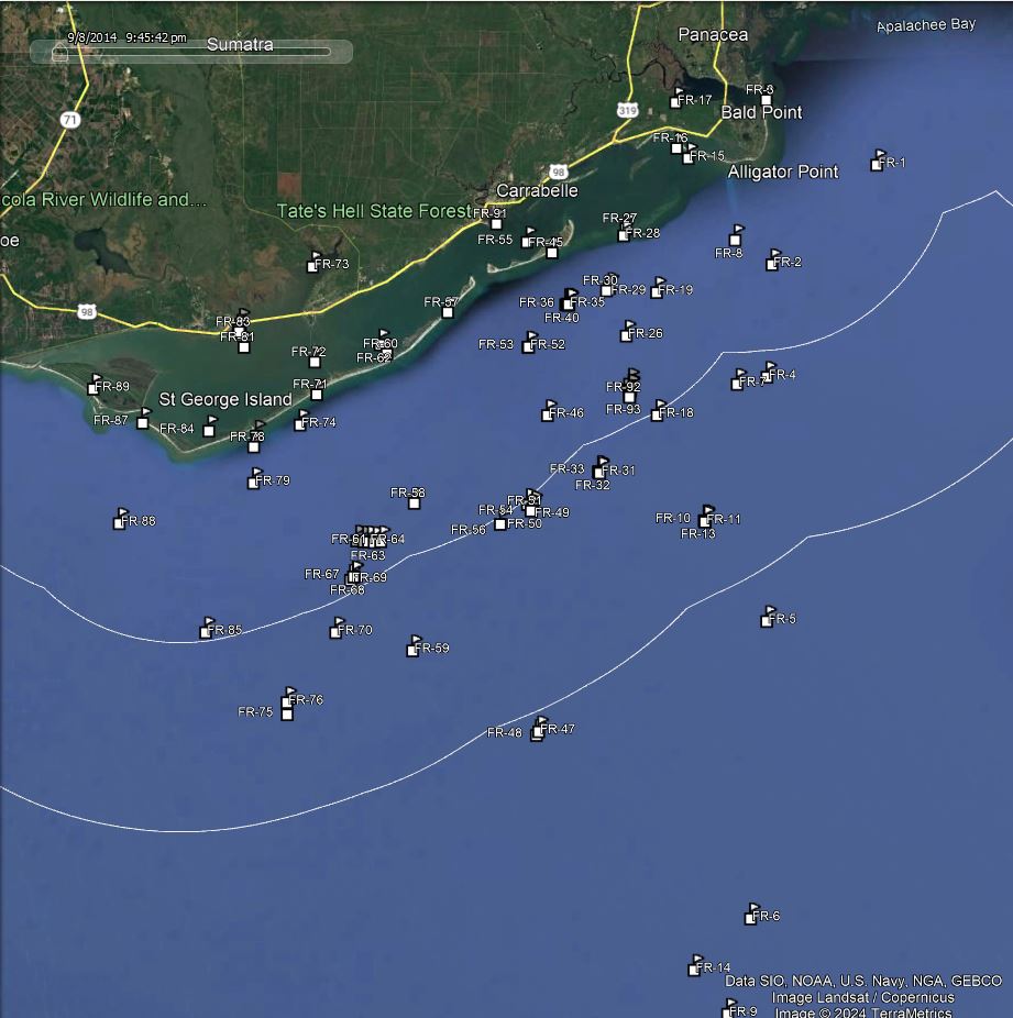
Click the Fishing & Dive Sites memory card image above to purchase Franklin County reef sites on a chip. The map below shows the reef site locations included and how they will look on your GPS unit. The site names, materials and rules are located inside the waypoint's description field. Visit Waypoints on GPS Units for more information.

| Site ID / Reef Name | Materials |
|---|---|
| FR-1 Ochlockonee Shoal | Bar SW Apalachee Bay |
| FR-2 Seaweed V | Wreck |
| FR-4 Gigi IV | Vessel |
| FR-3 Francille | Fishing Vessel |
| FR-5 V Tower | Nav Tower 100' above Water inside Hop Barge |
| FR-6 Pirates Lady Wreck | 72' Aluminum Yacht |
| FR-7 K Tower | Nav Tower 100' above Water inside Hop Barge |
| FR-8 Miss Tammy | Fishing Vessel |
| FR-9 SC Loveland | 1288 ton Cargo Ship |
| FR-10 Bryson Memorial Reef | 85'x35' Tugboat The Atlas |
| FR-11 Bryson Memorial Reef | 108'x35' Tugboat The Moonlighter |
| FR-12 Bryson Additions | 150 tons Concrete Culverts and Tanks between 2 Tugs |
| FR-13 Bryson Additions | 250 tons Concrete toward stern of Atlas |
| FR-14 Enjoy | 40' Pleasure Craft |
| FR-15 Karma | Fishing Vessel |
| FR-16 Bay Mouth Bar | Bar Fishing Area |
| FR-17 Shell Hammock | Island on west side Ochlockonee Bay |
| FR-18 New Moon | Vessel |
| FR-19 Smokehouse Ledge | Natural Reef |
| FR-96 Robby Redding Memorial 7 | 4 Walter Florida Limestone Reef Modules, 1 Ecosystem Reef |
| FR-95 Robby Redding Memorial 6 | 4 Walter Ecosystem Reefs on Pads Funded |
| FR-20 Robby Redding Memorial 3 | 5 Walter Grouper Box Modules |
| FR-21 Robby Redding Memorial 2 | 5 Walter Florida Special Steel Reef Modules |
| FR-22 Robby Redding Memorial 4 | 15 Concrete Culverts of Various Sizes |
| FR-23 Rose City Reef | 20 Fish Haven Towers and 30 Fish Havens |
| FR-93 Dixon Camp Memorial 2 | 10 Walter Florida Limestone Modules, Super Reef 1 AR inside |
| FR-92 Dixon Camp Memorial 1 | 10 Walter Florida Limestone Modules, Super Reef 1 AR Inside |
| FR-94 Dixon Camp Memorial 3 | 10 Walter FL Limestone Modules, Super Reef 1 AR inside |
| FR-24 Robby Redding Memorial 1 | 5 Walter Florida Limestone Reef Modules |
| FR-25 Robby Redding Memorial 5 | Steel Sculpture Prefab Steel 10'hx10'wx30'long |
| FR-26 Turtle Towers Ledge | Limestone Ledge runs east to west in semicircle |
| FR-27 Florida Gas Transmission B | Concrete Debris |
| FR-28 Dog Island Reef | Bar in St George Sound |
| FR-29 Two Dogs Reefballs | 130 Pallet Balls in 25 Patches 50 feet Apart |
| FR-30 Two Dogs Culverts | 130 Culverts 8'x18in 25 Patches 50 feet Apart |
| FR-31 Yamaha Reef - Southern Addition | 94 Total Large Concrete I-Beams Oar |
| FR-32 Yamaha Reef | 195'x35'x15' Stl Hopper Barge Concrete Bridge Pilings |
| FR-34 Yamaha Site Addition | Concrete Pilings |
| FR-33 Yamaha Reef Addition | Concrete Pilings and Concrete Culverts |
| FR-35 Carrabelle 3 Mile | 15 Concrete Culverts 22 Concrete Slabs |
| FR-36 Carrabelle 3 Mile | 23 Pieces Concrete Culverts |
| FR-37 Carrabelle 3 Mile | Concrete Culverts |
| FR-40 Carrabelle 3 Mile | 37 Pieces Concrete Culverts |
| FR-39 Carrabelle 3 Mile | 15 Concrete Culverts 15 Concrete Slabs |
| FR-38 Carrabelle 3 Mile | Concrete Culverts |
| FR-41 Carrabelle 3 Mile | 200 tons of Concrete Culverts |
| FR-42 Carrabelle 3 Mile | 30 Pieces Concrete Culverts |
| FR-43 Carrabelle 3 Mile | 30 Pieces Concrete Culverts |
| FR-44 Carrabelle 3 Mile | 19 Pieces Concrete Culverts off Site Pile |
| FR-45 Dog Island | Island south side St George Sound |
| FR-46 Lady Susan | Fishing Vessel |
| FR-47 S Tower | Nav Tower 100' above water inside Barge |
| FR-48 Exxon Template | Oil Rig Structure 95' square |
| FR-49 O Tower | Nav Tower 100' above water sitting in Barge |
| FR-50 Miss Jem | 50' Steel Shrimper draped in shrimp netting |
| FR-51 O Tower Barge | Metal Barge aka Carrabelle Reef Barge |
| FR-52 One More Time Addition | 75 Pcs 20 to 25 ft long 3.5'x2' Concrete Beams |
| FR-53 One More Time | 75' Steel Shrimp Boat sunk on the way out |
| FR-54 Carrabelle Reef Culverts | Concrete Rubble Pipes 4 Fuel Storage Tanks |
| FR-55 Sandy P | Fishing Vessel |
| FR-56 Carrabelle - Rotary | Concrete Culverts and Steel Storage Tanks |
| FR-91 Carrabelle River Inlet | GPS Waypoint from St. Georges Sound |
| FR-57 Marsh Island | Island north east side of St George Island |
| FR-58 Franklin County Reef - Bridge | Part of Bay Bridge mainly Slabs |
| FR-59 Dolphin | 85' Shrimper Boat |
| FR-60 Goose Island | Island inside Apalachicola Bay near east St George Island |
| FR-61 St George Island Bridge-East End | Single Concrete Bridge Span 55'x28'x6' |
| FR-62 East Pelican Reef | Bar in Apalachicola Bay |
| FR-63 St George IsBridge-East Central | Single Concrete Bridge Span 55'x28'x6' |
| FR-64 St George Island Bridge-Center | Single Concrete Bridge Span 55'x28'x6' |
| FR-65 St George Is Bridge-W Central | Single Concrete Bridge Span 55'x28'x6' |
| FR-66 St George Island Bridge-West End | 40 Concrete Bridge Pilings 20in'x20in'x20' |
| FR-67 City of Apalachicola Site | Bridge Rubble high part of Apalachicola Bridge |
| FR-68 Limestone Ledge | 6' high Limestone Ledges just South of City of Apalachicola |
| FR-69 Apalachicola City | 2 Barges 140x28x12 140x35x9 filled with 50 Tires each |
| FR-70 C Tower and Barge | Nav Tower 100' above water sitting in Barge |
| FR-71 Saint George Island | Island between Apalachicola Bay and Gulf of Mexico |
| FR-72 Bulkhead Shoal | Bar in Apalachicola Bay |
| FR-73 Tank Island | Island north NW East Bay |
| FR-74 Shortys Boy | Fishing Vessel |
| FR-75 Gelmer | Vessel |
| FR-76 Gilmer Dredge | 130' x 30' sits upside down - loaded with fish |
| FR-77 Pan Dallas | Fishing Vessel |
| FR-78 Little Saint George Island | Island south west side St George Island |
| FR-79 Davys Navy | Fishing Vessel |
| FR-80 Try Me | Fishing Vessel |
| FR-81 Little Tots | Fishing Vessel |
| FR-82 Big Townhead Island | Island east of Apalachicola |
| FR-83 Towhead Island | Island just off east tip of Apalachicola |
| FR-90 Apalachicola Inlet | GPS Waypoint Apalachicola Bay to Alligator Bayou |
| FR-84 Higgins Shoal | Bar in Apalachicola Bay NE of Horseshoe Cove |
| FR-85 Viking IV | Fishing Vessel |
| FR-86 Islander | Wreck |
| FR-87 Sand Island | Island west side of Apalachicola Bay |
| FR-88 L Buoy Reef | Concrete Rubble |
| FR-89 Saint Vincent Island | Island west side of Apalachicola Bay |


