Gulf County GPS Numbers
GPS Coordinates >Panhandle > Gulf
 Gulf County has, in addition to artificial reefs deployed by FWC, Mexico Beach
Artificial Reef Association (MBARA) and dozens of shipwrecks, natural reefs
just a few miles offshore in 80 to 100 feet of water providing even more structure to fish. St Joseph Bay is a popular fishing destination. Many in Gulf County will venture into Bay County south east of Panama City which has been called the second most popular area for fishing and diving in the state due to the abundance of reef sites, the clarity of the water, and the big fish that inhabit these sites. IMPORTANT: We have had reports recently that many artificial reef sites in Gulf County are gone or dispersed, frustrating anglers trying to find structure. Most sites on this list were laid in the the 1990's and from storm activity or the effects of time, these sites may be gone.
 Northwest Reefs & Shipwrecks
GPS Numbers File Downloads
 PDF
PDF  KML
KML  GPX
GPX
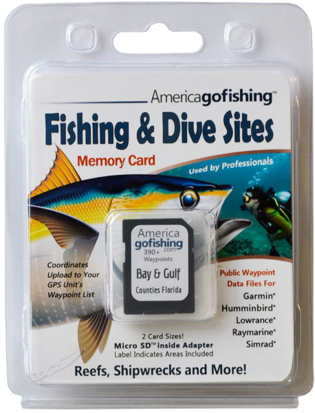
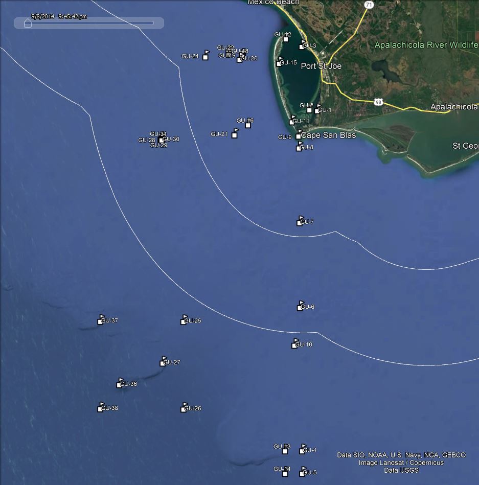
Click the Fishing & Dive Sites memory card image above to purchase Gulf County reef sites on a chip. The map below shows the reef site locations included and how they will look on your GPS unit. The site names, materials and rules are located inside the waypoint's description field. Visit Waypoints on GPS Units for more information.

| Site ID / Reef Name |
Materials |
| GU-1 Conch Island |
Island SE inside Saint Joseph Bay |
| GU-2 Blacks Island |
Island SE inside Saint Joseph Bay |
| GU-3 Dont Cha Know |
Submarine Wreck mast and rigging exposed |
| GU-4 Twin Ridges NE |
NE Gulf Deep Water Reef |
| GU-5 Twin Ridges SE |
NE Gulf Deep Water Reef |
| GU-6 Empire Mica |
479'x61' British Std Ocean Tanker scattered |
| GU-7 WTF14 Diver Down Flag 1 |
Dive spot on the way to Empire Mica |
| GU-8 Cape San Blas Shoals |
Bar south of Cape San Blas |
| GU-9 Cape San Blas Lighthouse |
65' No.3 Lighthouse built 1859 |
| GU-10 Bobo |
Vessel |
| GU-11 Pig Island |
Island SW inside Saint Joseph Bay |
| GU-12 Saint Joseph Point |
Northern tip of Saint Joseph Peninsula |
| GU-13 Twin Ridges NW |
NE Gulf Deep Water Reef |
| GU-14 Twin Ridges SW |
NE Gulf Deep Water Reef |
| GU-15 Pompano Point |
Deep Dip holds Pompano Mar to Nov |
| GU-16 Captain Kato |
65' Shrimper Fiberglass Hull burnd hull remains |
| GU-17 Jaycee Reef 1 |
Concrete Rubble and Steel Containers. |
| GU-18 Gatewood Barge |
70' Steel Barge |
| GU-19 Jaycee Reef 2 |
Concrete Rubble Car Bodies Steel Containers |
| GU-20 C of C Reef |
Concrete Rubble and Prefabricated Concrete |
| GU-21 LST Port St Joe |
75'x20' Mil Landing Craft sunk maiden voy |
| GU-22 Virginia Reef 1 |
Boat Hull Metal Crates and Concrete Rubble |
| GU-23 Virginia Reef 2 |
Bridge Rubble Concrete Boxes Steel Hoppers |
| GU-24 Gateway Barge |
70' Barge Steel Tanks Tires and Boxcars |
GU-25 Madison/Swanson NE |
Closed Nov 1 - Apr 30 surface trolling non-reef fish May-Oct |
GU-26 Madison/Swanson SE |
Closed Nov 1 - Apr 30 surface trolling non-reef fish May-Oct |
GU-27 Madison |
River Steamboat sunk during Civil War - wood ribs visible |
| GU-28 Sandy Reef Phase II; Patch 3 |
194 Reef Balls between 4 sites |
| GU-29 Sandy Reef Phase II; Patch 2 |
193 Reef Balls between 4 sites |
| GU-30 Sandy Reef Phase II; Patch 4 |
195 Reef Balls between 4 sites |
| GU-31 Sandy Reef Phase II; Patch 1 |
192 Reef Balls between 4 sites |
| GU-32 Sandy Reef 1 |
Bridge Spans |
| GU-33 Sandy Reef 2 |
Bridge Spans |
| GU-34 Sandy Reef 3 |
Bridge Spans |
| GU-35 Sandy Reef 4 |
Bridge Spans |
| GU-36 Swanson_MPA |
Vessel |
GU-37 Madison/Swanson NW |
Closed Nov 1 - Apr 30 surface trolling non-reef fish May-Oct |
GU-38 Madison/Swanson SW |
Closed Nov 1 - Apr 30 surface trolling non-reef fish May-Oct |
| GU-39 Barrier Dunes Barge |
200' Barge Wreck |
| GU-40 Mexico Beach Site - Hat |
No. 17 H.Bridge, 3 Spans, Concrete Decks |
| GU-41 Mexico Beach Site |
Boxcars |
| GU-42 Mexico Beach Site |
Scrap Steel and Tires |
| GU-43 Mexico Beach Site |
Boxcars |
| GU-44 Mexico Beach Site - Hat |
No. 11 H. Bridgen Steel Truss Spans |
|
| D = DEPTH - the depth of water in feet to the bottom in reef area |
R = RELIEF - the height that the materials rise above the bottom in feet |
Symbol Index |
 |
***The omission of symbols on charts does NOT mean it is OK to fish, lobster or spearfish a site - inquire about rules locally.
- Not for Navigational Use. GPS Numbers Are Not Guaranteed. There are No Warranties Expressed or Implied.
- Due to the Increased and Severity of Recent and Past Hurricane Activity it is Very Possible These Numbers May Be Off.
- Rules change frequently, always inquire locally before fishing, lobstering, or spearfishing.
Florida Go Fishing, Inc. provides this website as a public service. This data is provided as a tool to increase your fishing, boating and diving enjoyment and is not intended to be used for navigational purposes. Multiple resources were used to create our GPS coordinate lists. We are continually editing and updating our waypoint data to improve positional accuracy and information. Although periodically updated, this information may not reflect the data currently available for purchase on our store and we assume no liability either for any errors, omissions, or inaccuracies in the information provided regardless of the cause of such or for any decision made, action taken, or action not taken by the user in reliance upon any information provided herein. This information is provided only as a courtesy and there are NO guarantees, warranties, expressed or implied, or representations as to the accuracy of this content. We assume no responsibility for location changes or inaccuracies of rules, buoys, hazards, markers, or coordinates. If you find an error or omission in our data, please contact us with the correct information or submit a reef report and we will investigate the discrepancy and make necessary corrections.
Our GPS coordinate lists are DERIVED WORKS created from many sources. Reproduction or distribution of our lists in any format is a violation of Federal law and we will prosecute unlawful use or distribution of our data to the full extent of the law. This webpage is locked to prevent printing and copying of our copyrighted work.


 Gulf County has, in addition to artificial reefs deployed by FWC, Mexico Beach
Artificial Reef Association (MBARA) and dozens of shipwrecks, natural reefs
just a few miles offshore in 80 to 100 feet of water providing even more structure to fish. St Joseph Bay is a popular fishing destination. Many in Gulf County will venture into Bay County south east of Panama City which has been called the second most popular area for fishing and diving in the state due to the abundance of reef sites, the clarity of the water, and the big fish that inhabit these sites. IMPORTANT: We have had reports recently that many artificial reef sites in Gulf County are gone or dispersed, frustrating anglers trying to find structure. Most sites on this list were laid in the the 1990's and from storm activity or the effects of time, these sites may be gone.
Gulf County has, in addition to artificial reefs deployed by FWC, Mexico Beach
Artificial Reef Association (MBARA) and dozens of shipwrecks, natural reefs
just a few miles offshore in 80 to 100 feet of water providing even more structure to fish. St Joseph Bay is a popular fishing destination. Many in Gulf County will venture into Bay County south east of Panama City which has been called the second most popular area for fishing and diving in the state due to the abundance of reef sites, the clarity of the water, and the big fish that inhabit these sites. IMPORTANT: We have had reports recently that many artificial reef sites in Gulf County are gone or dispersed, frustrating anglers trying to find structure. Most sites on this list were laid in the the 1990's and from storm activity or the effects of time, these sites may be gone.![]() Northwest Reefs & Shipwrecks
Northwest Reefs & Shipwrecks![]() PDF
PDF ![]() KML
KML ![]() GPX
GPX


