Southeast Reefs & Shipwrecks
Locations >Southeast > Reefs & Shipwrecks
Palm Beach County
![]() GPS Coordinates Palm Beach County GPS File Downloads
GPS Coordinates Palm Beach County GPS File Downloads ![]() PDF
PDF ![]() KML
KML ![]() GPX
GPX
![]() Palm Beach Mooring Buoys
Palm Beach Mooring Buoys
![]() Jupiter Inlet Stepping Stone Reef
Jupiter Inlet Stepping Stone Reef ![]() Ocean Ridge Nearshore
Ocean Ridge Nearshore ![]() Riviera Beach Nearshore
Riviera Beach Nearshore
 The 3 parallel reef tracts that extend the length of Palm Beach County are very close to shore, the closest in the state, allowing shore divers and those with boats quick and easy access to some great fishing grounds. The Gulf Stream skirts the coast bathing it in crystal clear water, especially during high tides, making the water the color of Caribbean waters with excellent visibility. Palm Beach County is very active in placing artificial reefs to enhance fishing and diving opportunities. Red Reef Beach Park has a reef a few feet from shore for snorkelers and more placed on the same beach further out for divers and anglers. The reefs in front of the Breakers Hotel are simply amazing!
Danny McCauley Memorial Reef - Pocahontas Tug Boat
Built in 1944, the 110' WWII Canadian Pocahontas tug boat was sunk on February 22, 2013 as an artificial reef in memory of Danny McCauley of West Palm Beach. Danny was an avid diver and angler who lost his life at 17 in a car accident on February 22, 2012, exactly 1 year to the day of the Pocahontas sinking. Danny's parents, friends and coworkers raised $10,000 in his memory towards the $35,000 needed to acquire and sink Pocahontas at it's final resting place 2 miles NE of the Lake Worth Inlet in 74 feet of water.
The tug boat, which floated on the Miami River for 35 years, was cleared of hazards, doors removed, openings cut out providing great dive throughs, memorial crosses placed on deck, and large letters spelling "Danny" were welded to the bow. Resting upright with it's bow facing south near existing artificial materials and several vessels, the Pocahontas will surely attract many species of fish in no time. The Pocahontas is a stepping stone between the older reef placements to the south and the Royal Park Bridge materials to the north. This area is a great drift diving or fishing destination with strong currents sometimes present, so be aware!
Video is of Danny McCauley Memorial Reef Pocahontas Sinking
![]()
![]() Palm Beach Post News Article
Palm Beach Post News Article ![]() Florida Dive Connection Report
Florida Dive Connection Report
 |
| Courtesy Boynton Beach Historical Society |
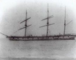
Lofthus 
Florida Underwater Archaeological Preserve & US National Register of Historic Places
Lofthus traveled the world as a merchant ship with gun ports painted on her sides to discourage pirate attacks. One of the last of the wind driven ships in existence, this type of Barque was only built for 60 years, thus this wreck is considered rare. Lofthus ran aground in 1898 on Boynton Beach. Smashing waves kept the ship on the beach and started tearing at the ship. The stranded ship was considered a loss, so the cargo of lumber was sold off and the hull was dynamited so that the lumber could be salvaged. The Lofthus now lies 3/4 of a mile north of Boynton Inlet, 175 yards offshore from Manalapan. The barque Oh Kim Soon was wrecked in the same location a year earlier, it's wreckage intermingled with the Lofthus.
![]() Lofthus Brochure
Lofthus Brochure ![]() Underwater Guide
Underwater Guide ![]() National Parks Service
National Parks Service ![]() Museums In the Sea Underwater Tour
Museums In the Sea Underwater Tour
Broward County
![]() GPS Coordinates Broward County GPS File Downloads
GPS Coordinates Broward County GPS File Downloads ![]() PDF
PDF ![]() KML
KML ![]() GPX
GPX
The 3 parallel reef tracts that extend the length of Broward County are very close to shore, the furthest is only 1 mile from shore, allowing shore divers and those with boats quick and easy access to some great fishing grounds. Broward County has done a excellent job of positioning 122 mooring buoys, most in a straight line, right up the coast along the reefs. With little anchor damage, the reefs are in great condition, loaded with marine life. Every beach allows divers and spearo's access to hunting grounds from shore, anglers can fish on beaches and there are large fishing piers in every community. For those with a boat that want big fish or to dive, you can't beat the quick access to reefs - in just a mile or two you are in 90 foot water with some big species lurking below, ready to take your bait. Shipwrecks are abundant, both wrecks that sunk unintentionally and those placed as artificial reefs by the active Broward County's Natural Resources Planning and Management Division.
Ancient Mariner
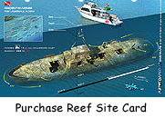 The Ancient Mariner was an ex-Coast Guard vessel called Nemesis, named after the Greek goddess of vengeance. The Nemesis was built as a Prohibition Runner by Marritte Mfg. Company in Pt. Pleasant, West Virginia. Her keel was laid on November 17, 1933; she was launched on July 7, 1934, and was commissioned on October 10. The Nemesis was 165 feet long, had a 25 foot beam and displaced 370 tons. She was a class "B" cutter and was powered to a top speed of 12.9 knots by two 1,340 hp diesel engines and two three blade propellers. Her crew consisted of four officers, one warrant and 50 men.
 The Nemesis never had the chance to chase rum runners as prohibition ended in 1933, a year before she was launched. During World War II the Nemesis was used as a sub-chaser and escort for convoys. Some sources state that she dropped depth charges on a submarine in August of 1942. She also rescued survivors from the torpedoed tankers Faja De Oro and SS Suwied in 1942. She was decommissioned on November 20, 1964, and sold to Auto Marine Engineers on February 9, 1966. In 1979 investors purchased the vessel and re-modeled her to look like a three deck African steamer. She was renamed Livingston Landing and became Ft. Lauderdale's first floating restaurant. The Livingston Landing closed in 1981. On April 28, 1981, the vessel now named Ancient Mariner sunk at its dock. She was re-floated and re-opened as a restaurant. In 1986 more than 100 patrons of the restaurant contracted hepatitis after dining aboard the old cutter, the restaurant could not survive the bad publicity and went bankrupt. The vessel re-opened under several names including Chapman's River Raw Bar, Anchorage Seafood, Dockside 501 and Cutters, but none lasted too long. She was purchased by the South Florida Divers Club of Hollywood for $6,000.00, and donated to Broward County's artificial reef program.
In June of 1991, the Nemesis, now called Ancient Mariner, was sunk as an artificial reef off Deerfield Beach. She now sits upright in 70 feet of water with a slight port list.
![]() GPS Numbers
GPS Numbers
Captain Dan
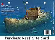 The Hollyhock was a 175-foot U.S. Coast Guard buoy tender built in March of 1937 in Milwaukee, Wisconsin. In 1959, she was moved to Detroit, Michigan, where she was used as an ice breaker in Lake Michigan. She later served in Miami, Florida -- also as a buoy tender -- and in the Bahamas for refueling seaplanes for the U.S. Air Force. In 1982, the Hollyhock was decommissioned by the Coast Guard and was later purchased by a missionary and renamed the Good News Mission Ship, where she went from port to port spreading the Gospel. She became stranded in the Miami River, and with the help of the Boating Improvement Program Fund and the Pompano Beach Fishing Rodeo, she was purchased to become an artificial reef.?
In February of 1990, the ship was renamed and reefed in memory of Captain Dan Garnsey, a well-known Pompano Beach drift fishing boat owner. Today, the ship lies upright in 110 feet with her bow pointing south. The wheelhouse is 70 feet below the surface and her deck is at 90 feet below the surface. The ship is intact and has been prepared with large access holes providing certified wreck divers easy opportunity for penetration.![]() GPS Numbers
GPS Numbers
 |
| Photo courtesy of the Florida Maritime Heritage Trail, Florida Division of Historical Resources |
SS Copenhagen 
Florida Underwater Archaeological Preserve & US National Register of Historic Places
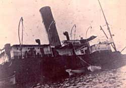
The SS Copenhagen is an Underwater Archaeological Preserve located ? of a nautical mile offshore of Lauderdale-by-the-Sea on the second reef line just south of the Hillsboro Inlet. This British steel-hulled schooner-rigged screw steamship was built in 1898. This 325'x47'x25' ship transported cargo across the Atlantic and along the east coast of the US. In 1900, it's second year of service, the SS Copenhagen met it's fate during a voyage transporting 4,940 tons of coal from Pennsylvania to Cuba. The ship suddenly ran aground on a reef and could not free itself. The crew tried off loading cargo but failed to remove the vessel from the reef, ultimately abandoning ship. The ship was visible above the water for some time until it was used for target practice in WWII and eventually sunk. The the bow section was removed during an excavation attempt and presently lies 200 yards southeast of the wreck. Much of this ships structure has become part of the reef it rests on but is still an interesting site to dive. The FloridaGoFishing crew visited the Copenhagen on a charter tour during the busy 2012 Mini Lobster Season. The wreckage was scattered and ship not visible but the reef itself was a nice site to dive, loaded with marine life.
Watch this video on Scuba Diving the SS Copenhagen
![]() Brochure
Brochure ![]() Underwater Guide
Underwater Guide ![]() National Parks Service
National Parks Service ![]() Museums In the Sea Underwater Tour
Museums In the Sea Underwater Tour
![]() GPS Numbers
GPS Numbers
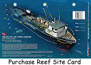
Miracle of Life
The Nursery
The Nursery is on the 1st reef line across from Pompano Beach. This natural reef has many undercuts and is named after the resident Nurse Sharks that have made this site home. The Sharks are so friendly on this shallow reef, you can snorkel within feet of the Sharks without fear. They usually migrate to the undersides of large boats in the shade. This site is an excellent dive for novice divers and is also great for fishing. Tie up to one of the many mooring buoys available and enjoy. Anglers should be aware of divers in the area and respect their space, especially if they were there first.
 Ronald B Johnson & Corey N Chris
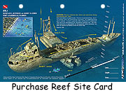
On May 18, 1986, a 130 foot US Army dredge, the Corey N Chris, was sunk in 260 feet of water as part of the Broward County artificial reef program. Then, on May 15, 1988, a 226 foot freighter, the Ronald B. Johnson, was sunk as part of the same program. The R.B.J. landed, by accident, right on top of the Corey N Chris. What luck! Today, these wrecks sit upright in 260 feet of water, joined by impact at their sterns. While this dive is still sometimes done on air, trimix is the gas of choice if you want to remember what you saw.
![]() GPS Numbers
GPS Numbers
 Rodeo 25 - Winward Trader
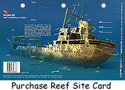
This Dutch freighter was built in 1956 as the Nore. She was 215 feet long, had a 33 foot beam and a 12 foot draft. In 1969 she was sold and renamed Booker Trojan; in 1976 she was renamed Caricom Adventurer and then renamed once again Cari Gulf Venture. In 1986 she was renamed Windward Trader. The Windward Trader became a derelict on the Miami River and was sunk as an artificial reef on May 12, 1990. Almost 100,000 spectators witnessed the event which was timed to celebrate the Pompano Beach Fishing Rodeo's 25th, anniversary. This two mast freighter, now known as the Rodeo 25, sits intact and upright in 122 feet of water. Her masts rise to within 52 feet of the surface. ![]() GPS Numbers
GPS Numbers
Miami-Dade County
![]() GPS Coordinates Miami-Dade
GPS Coordinates Miami-Dade ![]() Biscayne NP Waterways
Biscayne NP Waterways ![]() Biscayne Nat. Park GPS File Downloads
Biscayne Nat. Park GPS File Downloads ![]() PDF
PDF ![]() KML
KML ![]() GPX
GPX
 |
| Source: National Park Service |
Lugano 
 |
| Source: Museums in the Sea |
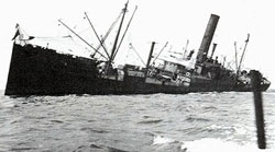
Lugano is a 350'x40' Iron Hulled British Steamer built 1882, formerly named Navarro. In 1913 while on route from Liverpool to Havana to deliver rice, silks, and wines valued at $1,000,000, Lugano grounded on Long Reef in Biscayne Bay. Being off course during high winds and high sea caused her fate. Read the interesting story of the unloading of her cargo and the ensuing mayhem on the National Parks Service website link below. There are 3 mooring buoys on this site; use is limited to four hours by any one boat. ![]() Biscayne National Park
Biscayne National Park
Scuba Diving the Lugano
Half Moon 
Florida Underwater Archaeological Preserve & US National Register of Historic Places
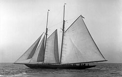
Half Moon is a 154'x40' Steel Schooner Yacht built in 1908, located on a shoal just outside Bear Cut between Key Biscayne and Virginia Key. This fast racing ship was purchased in Germany as a gift to a husband and raced for many years until it was confiscated as a prize of war in 1914. Half Moon was sold several times and made it's way to Miami becoming a floating saloon, cabaret, and restaurant during Prohibition. Eventually it was sold and converted into a private floating fishing pier off Miami where it sunk in a 1930 storm. This yacht sits on it's port side and is mostly in tact and just 4 feet below the water surface, so use caution when approaching the site. 2 mooring buoys available at this site. ![]() Half Moon Brochure
Half Moon Brochure ![]() Underwater Guide
Underwater Guide
![]() National Parks Service
National Parks Service ![]() Museums In the Sea Underwater Tour
Museums In the Sea Underwater Tour
Biscayne Maritime Heritage Trail 
The Biscayne Maritime Heritage Trail is an ongoing project of documenting shipwrecks within Biscayne National Park. So far 6 ships have been documented, mooring buoys installed, and waterproof site cards are available for diving. ![]() Maritime Heritage Trail
Maritime Heritage Trail
Legare Anchorage & HMS Fowey
Legare Anchorage is an off-limits marine zone in Biscayne National Park. Legare Anchorage encompasses an area 2.5 miles square located to the east of Sands Key. You are not allowed to stop your boat, snorkel, dive, fish, or anchor in this area. The only activity allowed is trowelling. Check out the chart below for the location of Legare Anchorage. This area is actively patrolled, so don't even think about sticking your head in the water (or even an underwater viewing device); what's underwater in this area is top-secret! Well, not so secret...
The wreckage of HMS Fowey is believed to be in the Legare Anchorage. HMS Fowey sunk in 1748 and it's location was unknown until a diver discovered it in October 1979. The diver went to the US government for permission to excavate the site. This immediately created a dispute that eventually went to court. As to the identity of the wreck - was it from the Spanish Fleet or was it British? The following sideshow is very interesting and shows how it was finally decided that the HMS Fowey is indeed in Legare Anchorage.
Biscayne National Park
Biscayne National Park encompasses a large area and contains a lot of regulations. Before visiting, please study the below map and also read the regulations. ![]() Plan Your Visit to Biscayne Bay
Plan Your Visit to Biscayne Bay ![]() Biscayne Bay National Park
Biscayne Bay National Park
Multiple resources were used to creatour Florida GPS Coordinates Reef Charts. This data is provided as a tool to increase your fishing and/or diving enjoyment and is not intended to be used for navigational purposes. This information is provided only as a courtesy and there are NO guaranties, warranties, express or implied, or representations as to the accuracy of this content. Florida Go Fishing assumes NO liability or responsibility for any errors or omissions in the information contained here AND is not responsible for location changes or inaccuracies of rules, buoys, hazards or markers. If you find an error or omission in the data, please feel free to contact us with the correct information and we will verify and correct it as soon as possible.


