St. Lucie County GPS Numbers
GPS Coordinates > Central East > St. Lucie
 St. Lucie County has numerous offshore artificial reefs and wrecks deployed by both the county and FWC. The Fort Pierce inlet and inshore along Hutchinson Island offer the safest
inlets in the area (50 miles in either direction) with the most productive fishing for the same distance. St. Lucie County includes several shipwrecks of the 1715 Spanish Silver Plate Fleet. Coins come up from the deep even today, so be on the look out for these little treasures when on the beach. There are numerous shipwrecks from this fleet offshore and we indicate them on our chart list. You can dive and fish these sites but cannot take artifacts! There are also more reefs to fish in neighboring counties Indian River and Martin County.
GPS Numbers File Downloads
![]() PDF
PDF ![]() KML
KML ![]() GPX
GPX
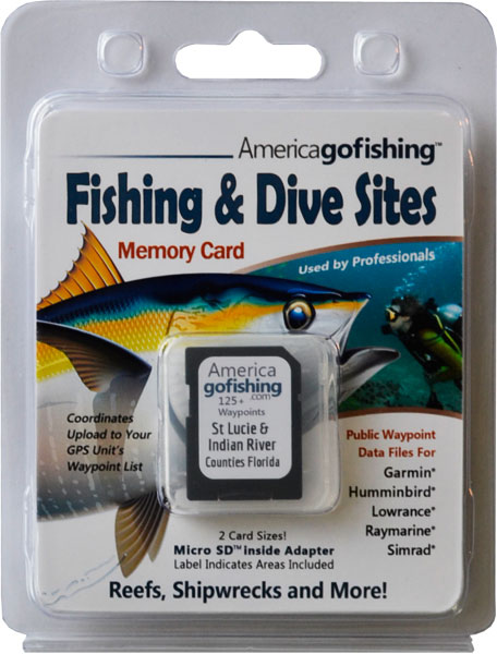
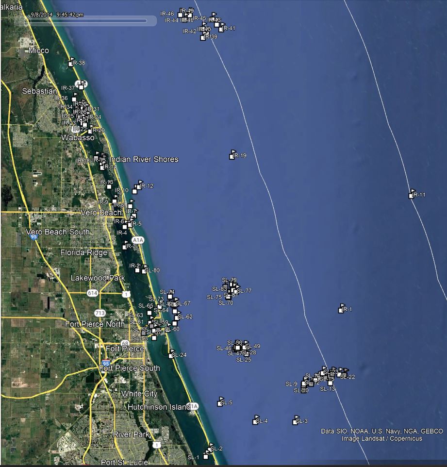
Click the Fishing & Dive Sites memory card image above to purchase St Lucie County reef sites on a chip. The map below shows the reef site locations included and how they will look on your GPS unit. The site names, materials and rules are located inside the waypoint's description field. Visit Waypoints on GPS Units for more information.

| Site ID / Reef Name | Materials |
|---|---|
| SL-1 Nettles Island | Island west side of Hutchinson Island |
| SL-2 Hutchinson Island | Island Port St Lucie |
| SL-3 Halsey | 433'x56' Steam Tanker 1920 oil gasoline naptha |
| SL-4 Saint Lucie Shoal | Bar near Jensen Beach |
| SL-5 Pierce Shoal | Shoal |
| SL-6 Bob Herbst Sr Reef 1 | 515 tons Culverts and 482 tons Poles |
| SL-7 Amazon Wreck Enhance 1 | 526 tons Concrete Rubble and Culverts |
| SL-8 Amazon Wreck Enhance 4 | 526 tons Concrete Rubble and Culverts |
| SL-9 Amazon Wreck Enhance 3 | 473 tons Concrete Rubble and Culverts |
| SL-10 Amazone | 255'x37' Dutch Freighter of 1294 tons-cargo coffee oil |
| SL-11 North County Offshore | 500 tons FPL Concrete Power Poles |
| SL-12 Amazon Wreck Enhance 2 | 485 tons Concrete Rubble and Culverts |
| SL-13 Beverly M Reef | 65' Derelict Steel Tug Boat |
| SL-14 Offshore Reef 02 | 1034 tons Con Culverts Light Poles Con Slabs Steel Safes |
| SL-15 Offshore Site-120 Reef | 547 tons Culverts and 514 tons Railroad Ties |
| SL-16 Offshore Site-140 Reef | 585 tons Culverts and 555 tons Railroad Ties |
| SL-17 Tug Lesley Lee Reef | 50' Steel Tugboat 18 tons of Concrete Inside |
| SL-18 Offshore Reef 01 | 960 tons Con Culverts Light Poles Con Slabs Steel Safes |
| SL-19 Tug Reef | 50' Steel Tugboat with 18 tons of Concrete Inside |
| SL-20 USS Muliphen | 459'x63' C-2 Attack Cargo Ship built 1944 |
| SL-21 Stans Reef 1 | 150' Oceangoing Tugboat |
| SL-22 Ft Pierce Artificial - Deep Tug | 155' Steel Tug Boat |
| SL-23 Ken M Reef | 71' Harbor Tugboat The Ken M |
| SL-24 Nieves aka Douglas Beach Wk | Galleon storm 1715 ballast pile 300' from shore |
| SL-25 50 Inshore Reef Site 1 | 110'x28x7' High Steel Barge |
| SL-26 50 Inshore Reef Site 2 | 50' Concrete Sailboat Ft Pierce Ins Concrete |
| SL-27 St Lucie Nearshore Site 06-01 | Concrete Dock Piles 2'x2''x20-30' |
| SL-28 St Lucie Nearshore Site 06-03 | Concrete Dock Piles 2'x2''x20-30' and Rubble |
| SL-29 Concrete Bridge Span 1 | Concrete Bridge Span |
| SL-30 TV Barge | 68' Steel Barge |
| SL-31 Concrete Bridge Span 2 | Concrete Bridge Span |
| SL-32 Bridge Spans 1 | Concr Bridge Span Support Section Martin Bridge |
| SL-33 Bridge Spans 2 | Concr Bridge Span Support Section Martin Bridge |
| SL-34 St Lucie Nearshore Site 06-02 | Concrete Dock Piles 2'x2''x20-30' |
| SL-35 Two Barges Reef | 61'x31'x12' Steel Barge |
| SL-36 Ft Pierce Fish Haven | 100'x40'x8' Steel Deck Barge |
| SL-37 Concrete Bridge Span 3 | Concrete Bridge Span |
| SL-38 FEC Railroad Ties | FEC Concrete Railroad Ties |
| SL-39 Concrete Bridge Span 4 | Concrete Bridge Span |
| SL-40 Concrete Bridge Span 5 | Concrete Bridge Span |
| SL-41 Railroad Tie Reef 1 | FEC Concrete Railroad Ties 440 tons |
| SL-42 Concrete Bridge Span 6 | Concrete Bridge Span |
| SL-43 Lees Barge | 90' Steel Barge |
| SL-44 Railroad Tie Reef 3 | Concrete Rubble and Steel Materials, 23 FPL Poles |
| SL-45 Concrete Bridge Span 7 | Concrete Bridge Span |
| SL-46 Civic Center Reef 1 | 40' Sterling Barge Bow Rubble Beams |
| SL-47 St Lucie Nearshore Site 06-04 | Concrete Dock Piles 2'x2''x20-30' and Rubble |
| SL-48 Concrete Bridge Span 8 | Concrete Bridge Span |
| SL-49 Bob Herbst Sr Reef 2 | 630 tons Culverts and 461 ton |
| SL-50 Civic Center Reef 2 | 140' Sterling Barge Stern and Rubble Beams Culverts |
| SL-51 Bridge Spans 3 | Concrete Bridge Span Support Section Martin Bri |
| SL-52 Fishing Club Reef | Concrete Rubble |
| SL-53 Causeway Island | Island inside Fort Pierce Inlet |
| SL-54 Taylor Creek Inlet | GPS Waypoint from Indian River |
| SL-55 Shortys Slough Inlet | GPS Waypoint from Fort Pierce Inlet - strong current |
| SL-56 Coon Island | Island inside Fort Pierce Inlet |
| SL-57 Fort Pierce Inlet Entrance | GPS Waypoint |
| SL-58 Jim Island | Island on N Beach Causeway Dr Fort Pierce |
| SL-59 Hutchinson Island Reef | Steel Tanks and Fiberglass Boat Hulls |
| SL-60 Ft Pierce Artificial Reef | 5 Barge loads each 25'x60' |
| SL-61 Mangrove Island | Island north of N Beach Causeway Dr Fort Pierce |
| SL-62 Wendys Reef | Concrete Culverts and Debris Prefabricated Structures |
| SL-63 Jack Island | Island on Intercoastal - Pepper Beach State Rec Area |
| SL-64 Ft Pierce Fish Haven 1 | 200 tons of Concrete Culverts - lots of fish |
| SL-65 Urca De Lima |
Galleon sank in storm of 1715 200 yds from shore |
| SL-66 Two Bridges Reef | 600 tons of Concrete Bridge Material |
| SL-67 Ft Pierce Fish Haven | Concrete Culverts Bridge Rubble Tires Scrap Metal |
| SL-68 Ft Pierce Fish Haven 2 | 600 tons of Concrete Culverts and Modules |
| SL-69 Fish America Foundation 4 | 1000 tons of Secondary Concrete |
| SL-70 FAF Reef 1 | 1000 tons mixed Concrete Materials |
| SL-71 Fish America Foundation 1 | 65'x40'x5' DMC Steel Deck Barge |
| SL-72 Fish America Foundation 2 | 566 tons of Secondary Concrete |
| SL-73 Ft Pierce Reef Site | Concrete Tires and RipRap some Scrap Steel |
| SL-74 Ft Pierce Artificial Reef | Metal Tanks and Concrete Culverts 15 Mixers |
| SL-75 Fish America Foundation 3 | 500 tons of Secondary Concrete |
| SL-76 FAF Reef 2 | 500 tons mixed Concrete Materials |
| SL-77 2011 Reef 2 | 991 tons Concrete Culverts Light Poles |
| SL-82 North County Nearshore 2015 | Concrete Culverts, Power Poles, Bridge Pieces |
| SL-81 North County Nearshore 2014 | 493 tons FPL Power Poles and 1024 tons Concrete |
| SL-83 North County Nearshore 2016 | 1550 tons Culverts, Drainage Structures, Bridge Pieces |
| SL-78 North County Nearshore 2013 | 500 tons FPL Concrete Power Poles |
| SL-79 2011 Reef 1 | 495 tons Concrete Culverts Light Poles Bridge Piles |
| SL-80 North Hutchinson Island | GPS Waypoint - Round Island Park West |


