Manatee County GPS Numbers
GPS Coordinates > Central West > Manatee
 Manatee County with Bradenton, Longboat Key, Anna Maria Island, and Palmetto,
is located
south of Tampa Bay, north of Sarasota, has over 150 miles of coastline
and 27 miles of white sand beaches. Coastal habitats include mangrove forests, seagrass beds, salt marshes and mud flats. Manatee County waters provide excellent recreational boating, fishing, and wildlife viewing. Squeezed between Sarasota County and the Skyway Bridge at the entrance to Tampa Bay, your choices of offshore reefs is endless, visit Pinellas, Hillsborough & Sarasota Counties for nearby GPS numbers. For inshore fishing, locals refer to the many waterways intersecting Manatee County as The "Backcountry" which include the Manatee River, Miguel Bay, Joe's Bay, Bishop Harbor, and Terra Ceia Bay. If your looking for some big fish like Kings, head to Egmont Channel for some trolling.
 ![]() Central West Reefs & Shipwrecks
Central West Reefs & Shipwrecks
GPS Numbers File Downloads
![]() PDF
PDF ![]() KML
KML ![]() GPX
GPX
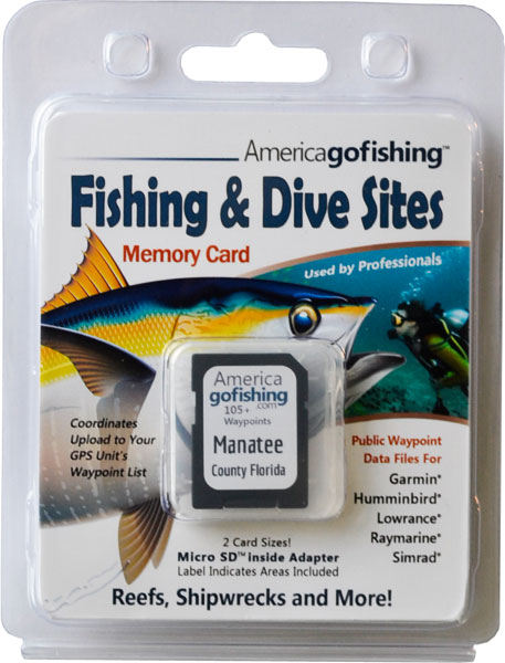
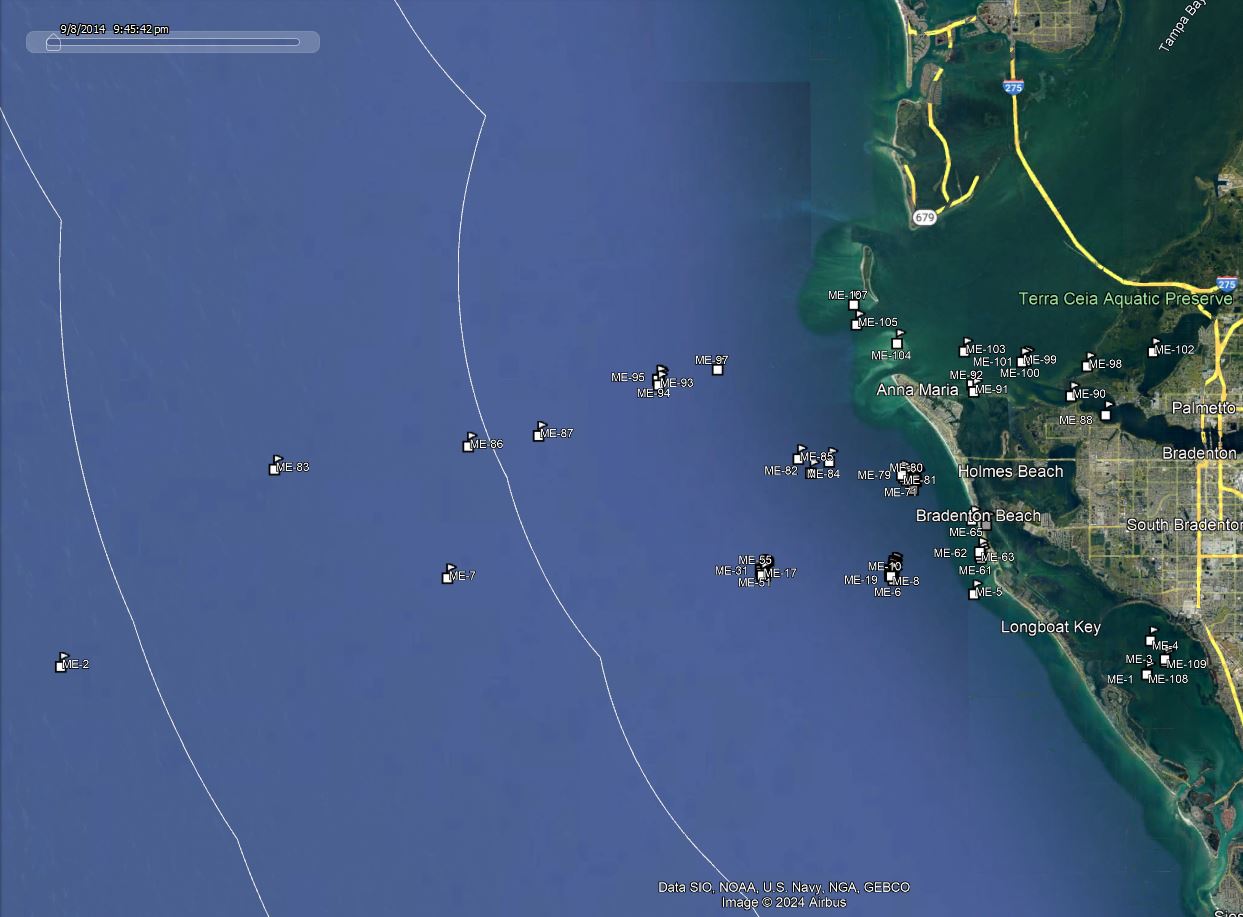
Click the Fishing & Dive Sites memory card image above to purchase Manatee County reef sites on a chip. The map below shows the reef site locations included and how they will look on your GPS unit. The site names, materials and rules are located inside the waypoint's description field. Visit Waypoints on GPS Units for more information.

| Site ID / Reef Name | Materials / Description |
|---|---|
| ME-1 Whale Key 4 | 11 Reef Ball Modules |
| ME-108 Whale Key 5 | 10 Reef Ball Modules |
| ME-2 Big Jack Hole | 70' wide opening to 200' wide by 370' deep Sink Hole |
| ME-3 Bayshore-South 2 | 11 Reef Ball Modules |
| ME-109 Bayshore South 1 | 11 Reef Ball Modules |
| ME-4 Bayshore-North 3 | 20 Reef Ball Modules |
| ME-5 Longboat Pass | GPS Waypoint |
| ME-6 3 Mile South Reef D | 40 Reef Balls-Bay Balls |
| ME-7 South Jack Wreck - Nohab | 142'x23' Steel Luxury Yacht cir 1901 as Lensahn III |
| ME-8 3 Mile South Reef D | 20 Reef Balls-Bay Balls |
| ME-9 3 Mile South Reef D | 50 Reef Balls-Bay Balls |
| ME-10 3 Mile South Reef D | Concrete |
| ME-11 7 Mile South Reef P | 20 Bay Balls |
| ME-12 7 Mile South Reef C | 1.5'x1.5'x25' Poles and 3'x1'x15' Bridge Structures |
| ME-13 3 Mile South Reef D | Concrete |
| ME-14 7 Mile South Reef C | 24 Light Poles stacked up 50'x20'x10' Lincoln Logs |
| ME-15 3 Mile South Reef D | 20 Reef Balls-Bay Balls |
| ME-16 3 Mile South Reef D | 40 Reef Balls-Bay Balls |
| ME-17 7 Mile South Reef ER | Eternal Reef Project 20 Reef 4 Pallet and 6 Bay Balls |
| ME-18 3 Mile South Reef D | 100 tons Concrete |
| ME-19 3 Mile South Reef D | Concrete Light Poles |
| ME-20 7 Mile South Reef P | 20 Bay Balls |
| ME-21 South 3 Mile Reef | Concrete |
| ME-22 South 3 Mile Reef | Concrete |
| ME-23 South 3 Mile Reef | Concrete |
| ME-24 South 3 Mile Reef | Concrete |
| ME-25 3 Mile South Reef D | Concrete |
| ME-26 7 Mile South Reef C | 25 Bay Balls |
| ME-27 3 Mile South Reef D | 20 Reef Balls-Bay Balls |
| ME-28 7 Mile South Reef P | 4 Reef Balls 8 Pallet Balls 30 Bay Balls |
| ME-29 7 Mile South Reef C | 25 Bay Balls |
| ME-30 3 Mile South Reef D | Concrete |
| ME-31 7 Mile South Reef P | 36 Concrete Culverts half are nested |
| ME-32 3 Mile South Reef D | 20 Reef Balls-Bay Balls |
| ME-33 South 3 Mile Reef | Concrete |
| ME-34 7 Mile South Reef P | 40 Concrete Culverts half are nested |
| ME-35 7 Mile South Reef C | Culvert and Concrete Light Poles |
| ME-36 3 Mile South Reef D | 20 Reef Balls-Bay Balls |
| ME-37 7 Mile South Reef P | 40 Concrete Culverts half are nested |
| ME-38 3 Mile South Reef D | Concrete |
| ME-39 South 3 Mile Reef | Concrete |
| ME-40 3 Mile South Reef D | 36 Reef Balls-Bay Balls |
| ME-41 3 Mile South Reef D | 20 Reef Balls-Bay Balls |
| ME-42 7 Mile South Reef P | 6 Reef Balls10 Pallet Balls 30 Bay Balls |
| ME-43 3 Mile South Reef D | Concrete Slabs and Panels |
| ME-44 3 Mile South Reef D | 20 Reef Balls-Bay Balls |
| ME-45 7 Mile South Reef C | 110'x30'x7'H Barge with 8 8'x10'H Steel Drums attached |
| ME-46 3 Mile South Reef D | Concrete |
| ME-47 7 Mile South Reef C | 20 Pieces 1.5'x1.5'x25' Poles |
| ME-48 3 Mile South Reef D | Concrete |
| ME-49 3 Mile South Reef D | 20 Reef Balls-Bay Balls |
| ME-50 3 Mile South Reef D | Concrete |
| ME-51 7 Mile South Reef P | 20 Bay Balls |
| ME-52 3 Mile South Reef D | 20 Reef Balls-Bay Balls |
| ME-53 7 Mile South Reef C | Bridge Beams and Culverts |
| ME-54 7 Mile South Reef P | 2 Reef Balls 6 Pallet Balls 30 Bay Balls |
| ME-55 7 Mile South Reef C | 40 large Concrete Beams from a Bridge |
| ME-56 7 Mile Reef South | Tires Concrete Rubble and Culverts |
| ME-57 7 Mile Reef South | 375 tons of Concrete Culverts |
| ME-58 3 Mile South Reef D | 225 tons of Concrete Culverts |
| ME-59 3 Mile Reef South | 300 tons of Concrete Culverts |
| ME-60 3 Mile Reef South | 525 tons of Concrete Culverts |
| ME-61 Conquina Near Shore Reef | Skyway Bridge Materials |
| ME-62 Coquina Beach Reef-South | Limestone Rock Boulders 300'x375' |
| ME-63 Coquina Beach Reef-North | Limestone Rock Boulders 650'x180' |
| ME-64 Bradenton Beach City Pier | Artificial Reef |
| ME-65 Regina - Sugar Barge - Molasses | 247'x36'x14' Tanker Barge broken 75yd off Bredenton Beach |
| ME-66 1 Mile Reef 1 | Skyway Bridge Materials and Metal Pipes |
| ME-67 1 Mile Reef 5 | 1-Goliath 7 Ultras 13 Pallets and 27 Bay Balls |
| ME-68 1 Mile Reef 5 | 1-Goliath 7 Ultras 13 Pallets and 27 Bay Balls |
| ME-69 1 Mile Reef 5 | 1-Goliath 7 Ultras 13 Pallets and 27 Bay Balls |
| ME-70 1 Mile Reef 5 | 1-Goliath 7 Ultras 13 Pallets and 27 Bay Balls |
| ME-71 1 Mile Reef 5 | 1-Goliath 7 Ultras 13 Pallets and 27 Bay Balls |
| ME-72 1 Mile Reef 5 | 1-Goliath 7 Ultras 13 Pallets and 27 Bay Balls |
| ME-73 1 Mile Reef 5 | 1-Goliath 7 Ultras 13 Pallets and 27 Bay Balls |
| ME-74 1 Mile Reef 3 | 44 Reefballs |
| ME-75 1 Mile Reef 3 | 45 Reefballs |
| ME-76 1 Mile Reef 3 | 44 Reefballs |
| ME-77 1 Mile Reef 3 | 45 Reefballs |
| ME-78 1 Mile Reef 3 ER | 19 Reefballs |
| ME-79 1 Mile Reef 3 | 44 Reefballs |
| ME-80 1 Mile Reef 3 | 44 Reefballs |
| ME-81 1 Mile Reef 2 | 1000 tons of Concrete Culverts Bridge Spans |
| ME-82 3 Mile Reef North | Tires Concrete Rubble and Tiles |
| ME-83 Fin Barge | 300' Barge with 2 fin shaped keels near stern upside down |
| ME-84 3 Mile North Bridge Reef | Bridge Spans and Rubble |
| ME-85 3 Mile Reef - North B | Boat Molds Concrete Rubble and Solid Rubber Tires |
| ME-86 Docs Barge | 75' Barge broken in half upside down - Good spearfishing |
| ME-87 Dolphin Ledge | L Shaped Broken Ledge with coral |
| ME-88 Manatee River Inlet | GPS Waypoint |
| ME-89 Mexican Pride | 200' Vessel lies upright and in half - good spearfishing |
| ME-90 Manatee River-Emerson Point | Bay Mini Lo-Pro and Table Top Balls |
| ME-91 The Bulkhead | Bar with fishing on grass flats creeks bayous docks |
| ME-92 Anna Maria Sound | GPS Waypoint ICW |
| ME-93 7 Mile Reef North | Tires Concrete Rubble |
| ME-94 7 Mile North Reef | Culverts Rock and Bridge Slabs |
| ME-95 7 Mile North Reef | 130 2'x2'x18' Long Concrete Light Poles |
| ME-96 7 Mile North Reef | 160 2'x2'x18' Concrete Poles 12 8'x6'x4' Concrete Boxes |
| ME-97 Misener Barge | 100'x35'x8' Barge accidentally sunk by Misener Marine |
| ME-98 Terra Ceia Bay Inlet | GPS Waypoint from Tampa Bay |
| ME-99 SE Tampa Bay Bridge Reef | Bridge Spans and Rubble |
| ME-100 Southeast Tampa Bay | 175 Bay Reefballs in 10 Locations |
| ME-101 Southeast Tampa | Bay Mini Lo-Pro and Table Top Balls |
| ME-102 Bird Key | Island in Terra Ceia Bay - good fishing around island |
| ME-103 Bulkhead Reef | Bay Mini Lo-Pro and Table Top Balls |
| ME-104 Passage Key_NWR | Submerged Island S of Egmont Key - island closed to public |
| ME-105 Seaducer | 18' Cobia Vessel |
| ME-106 Millie R Bohannon-28 Fathom | 162' American Schooner built 1891 |
| ME-107 Cindy | Tugboat |


