Brevard County GPS Numbers
GPS Coordinates > Central East > Brevard

Brevard County is called the Space Coast because it is the home of Kennedy Space Center in Cape Canaveral. Brevard County list of reef site locations in Cape Canaveral, Cocoa Beach, Satellite Beach, Melbourne, Palm Bay, Micco, Sebastian and Indian River shores. There are artificial reefs for offshore fishing along with many WWII sunken ships. The Indian River Lagoon, Mosquito Lagoon, Banana River, and tributories provide great inshore fishing with thousands of inlets, islands, and honey holes to cast your line and go fishing! Diving and spearfishing peak season in Brevard County is the summer months which offer calmer water conditions and better visibility. ![]() Central East Reefs & Shipwrecks
Central East Reefs & Shipwrecks
GPS Reef Numbers File Downloads
![]() PDF
PDF ![]() KML
KML ![]() GPX
GPX
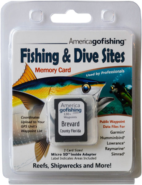
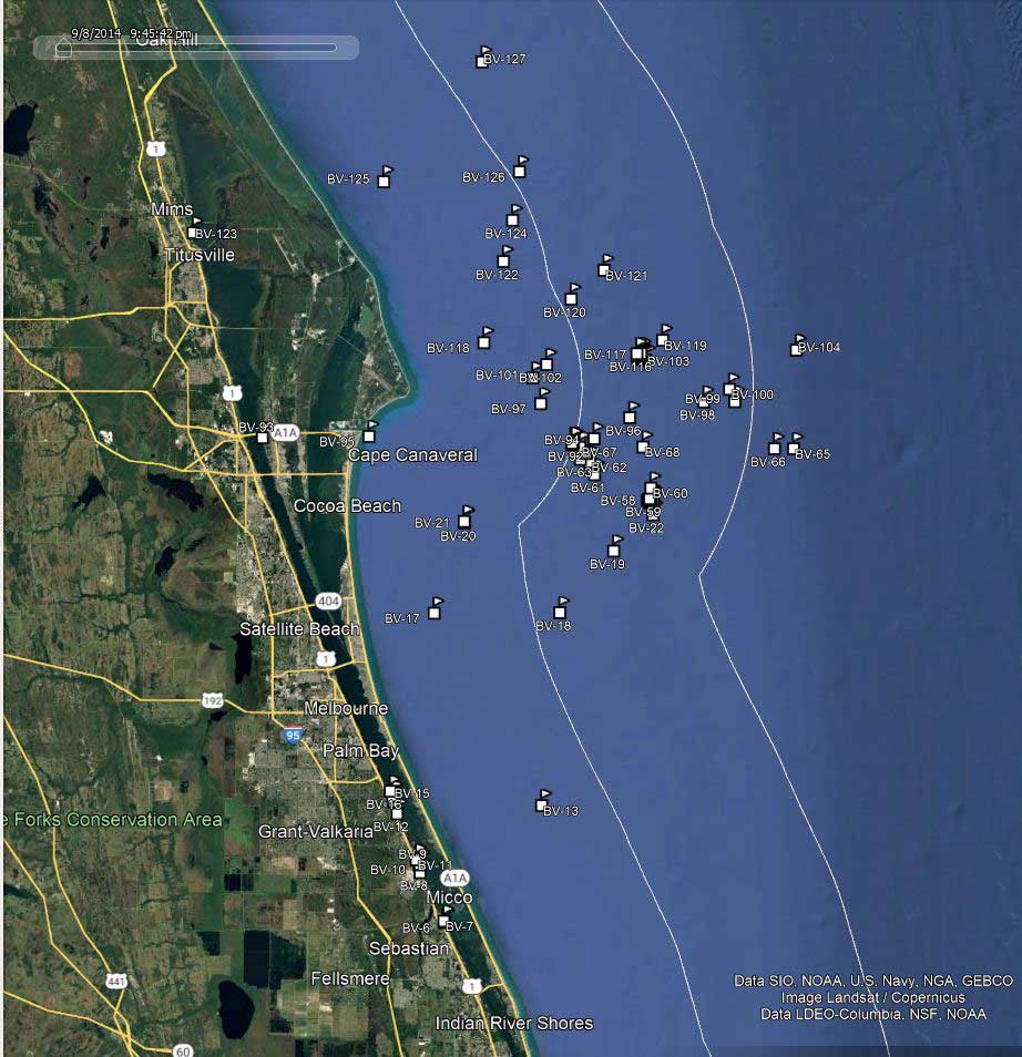
Click the Fishing & Dive Sites memory card image above to purchase Brevard reef sites on a chip. The map below shows the reef site locations included and how they will look on your GPS unit. The site names, materials and rules are located inside the waypoint's description field. Visit Waypoints on GPS Units for more information.

Brevard County list of reef site locations in Cape Canaveral, Cocoa Beach, Satellite Beach, Melbourne, Palm Bay, Micco, Sebastian and Indian River shores. Most offshire reefs are accessed from Cape Canaveral. Our fishing charts contain all sites listed below.
| Site ID / Reef Name | Materials / Description |
|---|---|
| BV-1 MC3 | Spoil Island on ICW |
| BV-2 MC1 | Spoil Island on ICW |
| BV-3 SL3 | Spoil Island on ICW |
| BV-4 IR36b | Spoil Island on ICW |
| BV-5 IR36a | Spoil Island on ICW |
| BV-6 IR1b | Spoil Island on ICW |
| BV-7 IR1a | Spoil Island on ICW |
| BV-8 BC48 | Spoil Island on ICW |
| BV-9 BC47b | Spoil Island on ICW |
| BV-10 BC47a | Spoil Island on ICW |
| BV-11 BC46 | Spoil Island on ICW |
| BV-12 BC40 | Spoil Island on ICW |
| BV-13 The Pines | Ledges run NW - SE |
| BV-14 BC38 | Spoil Island on ICW |
| BV-15 BC37 | Spoil Island on ICW |
| BV-16 BC36 | Spoil Island on ICW |
| BV-17 Korsholm | 336 ft 2647 ton Swedish Cargo Ship, demolished |
| BV-18 Liberty Wreck | Wreck broken up |
| BV-19 Pelican Flats Center | Natural Limestone Ledges large area runs N-S |
| BV-20 Brevard Reef 1 | Barge and 85' Sailboat |
| BV-21 Brevard Reef 2 Moby Dick | 100' Wooden Sailboat dumpsters lifeboats |
| BV-22 Shelby Lee | 65' Steel Recreational Vessel |
| BV-23 Titan II Transporter Site 26 | Steel from Titan II Transporter |
| BV-24 Titan II Transporter Site 27 | Steel from Titan II Transporter |
| BV-25 Titan Experimental Reef | 100' Barge; 4 55' Stainless Steel Tanks attach |
| BV-26 Titan II Transporter Site 18 | Steel from Titan II Transporter |
| BV-27 Titan II Transporter Site 10 | Steel from Titan II Transporter |
| BV-28 Titan II Transporter Site 7 | Steel from Titan II Transporter |
| BV-29 Titan II Transporter Site 31 | Steel from Titan II Transporter |
| BV-30 Titan II Transporter Site 2 | Steel from Titan II Transporter |
| BV-31 Steel Nasa Test Fixture | 135' Cylindr NASA mockup Shuttle Rocket Boostr |
| BV-32 CPA Reef | Stainless Steel Sphere 2 Large Storage Tanks |
| BV-33 Titan II Transporter Site 9 | Steel from Titan II Transporter |
| BV-34 Titan II Transporter Site 17 | Steel from Titan II Transporter |
| BV-35 Sufix I | 43' Concrete Sailboat |
| BV-36 Titan II Transporter Site 30 | Steel from Titan II Transporter |
| BV-37 Titan II Transporter Site 21 | Steel from Titan II Transporter |
| BV-38 Titan II Transporter Site 22 | Steel from Titan II Transporter |
| BV-39 Titan II Transporter Site 32 | Steel from Titan II Transporter |
| BV-40 Titan II Transporter Site 24 | Steel from Titan II Transporter |
| BV-41 Titan II Transporter Site 5 | Steel from Titan II Transporter |
| BV-42 Titan II Transporter Site 19 | Steel from Titan II Transporter |
| BV-43 Titan II Transporter Site 16 | Steel from Titan II Transporter |
| BV-44 Titan II Transporter Site 20 | Steel from Titan II Transporter |
| BV-45 Titan II Transporter Site 29 | Steel from Titan II Transporter |
| BV-46 Titan II Transporter Site 11 | Steel from Titan II Transporter |
| BV-47 Titan II Transporter Site 25 | Steel from Titan II Transporter |
| BV-48 Titan II Transporter Site 15 | Steel from Titan II Transporter |
| BV-49 Titan II Transporter Site 12 | Steel from Titan II Transporter |
| BV-50 Titan II Transporter Site 14 | Steel from Titan II Transporter |
| BV-51 Titan II Transporter Site 3 | Steel from Titan II Transporter |
| BV-52 Titan II Transporter Site 23 | Steel from Titan II Transporter |
| BV-53 Titan Transporter 4 | 22 Drops within 500' Radius 446 tons total |
| BV-54 Titan II Transporter Site 6 | Steel from Titan II Transporter |
| BV-55 Titan II Transporter Site 33 | Steel from Titan II Transporter |
| BV-56 Titan II Transporter Site 4 | Steel from Titan II Transporter |
| BV-57 Titan II Transporter Site 8 | Steel from Titan II Transporter |
| BV-58 Titan II Transporter Site 1 | Steel from Titan II Transporter |
| BV-59 Titan II Transporter Site 13 | Steel from Titan II Transporter |
| BV-60 Titan II Transporter Site 28 | Steel from Titan II Transporter |
| BV-61 Tiger Red | Tug Boat |
| BV-62 Artifical Site 1 | 50'x6' Concrete Catwalks 340 tons |
| BV-63 Concrete Pile Reef | Concrete Blocks |
| BV-64 Ocean Venus aka Lead Wreck | 425'x57' Steel Freightr WWII-cargo lead herring |
| BV-65 The Cones | Deep Water Ridges runs N-S - West side of Oculina Bank |
| BV-66 Cities Service Empire | 465' Tanker Ampetco torpedoed by the U-128, breaking up |
| BV-67 Reef Ball Reef | 80 and 70 Reef Balls |
| BV-68 Barge | Wreck |
| BV-69 Ebins Pyramid 3 | FL Limestone Pyramid 8'Tx10'W 15m off Port Canaveral |
| BV-70 Ebins Pyramid 2 | FL Limestone Pyramid 8'Tx10'W 15m off Port Canaveral |
| BV-71 Ebins Pyramid 1 | FL Limestone Pyramid 8'Tx10'W 15m off Port Canaveral |
| BV-72 Ebins Pyramid 4 | FL Limestone Pyramid 8'Tx10'W 15m off Port Canaveral |
| BV-73 Ebins Pyramid 5 | FL Limestone Pyramid 8'Tx10'W 15m off Port Canaveral |
| BV-74 Ebins Pyramid 8 | FL Limestone Pyramid 8'Tx10'W 15m off Port Canaveral |
| BV-75 Ebins Pyramid 7 | FL Limestone Pyramid 8'Tx10'W 15m off Port Canaveral |
| BV-76 Ebins Pyramid 6 | FL Limestone Pyramid 8'Tx10'W 15m off Port Canaveral |
| BV-77 Ebins Pyramid 12 | FL Limestone Pyramid 8'Tx10'W 15m off Port Canaveral |
| BV-78 Ebins Pyramid 11 | FL Limestone Pyramid 8'Tx10'W 15m off Port Canaveral |
| BV-79 Ebins Pyramid 10 | FL Limestone Pyramid 8'Tx10'W 15m off Port Canaveral |
| BV-80 Ebins Pyramid 9 | FL Limestone Pyramid 8'Tx10'W 15m off Port Canaveral |
| BV-81 Ebins Pyramid 14 | FL Limestone Pyramid 8'Tx10'W 15m off Port Canaveral |
| BV-82 Ebins Pyramid 13 | FL Limestone Pyramid 8'Tx10'W 15m off Port Canaveral |
| BV-83 Ebins Pyramid 16 | FL Limestone Pyramid 8'Tx10'W 15m off Port Canaveral |
| BV-84 Ebins Pyramid 15 | FL Limestone Pyramid 8'Tx10'W 15m off Port Canaveral |
| BV-85 Ebins Pyramid 20 | FL Limestone Pyramid 8'Tx10'W 15m off Port Canaveral |
| BV-86 Ebins Pyramid 19 | FL Limestone Pyramid 8'Tx10'W 15m off Port Canaveral |
| BV-87 Ebins Pyramid 17 | FL Limestone Pyramid 8'Tx10'W 15m off Port Canaveral |
| BV-88 Ebins Pyramid 18 | FL Limestone Pyramid 8'Tx10'W 15m off Port Canaveral |
| BV-89 Ebins Pyramid 24 | FL Limestone Pyramid 8'Tx10'W 15m off Port Canaveral |
| BV-90 Ebins Pyramid 23 | FL Limestone Pyramid 8'Tx10'W 15m off Port Canaveral |
| BV-91 Ebins Pyramid 22 | FL Limestone Pyramid 8'Tx10'W 15m off Port Canaveral |
| BV-92 Ebins Pyramid 21 | FL Limestone Pyramid 8'Tx10'W 15m off Port Canaveral |
| BV-93 Canaveral Barge Canal W Inlet | GPS Waypoint from Indian River |
| BV-94 Damocles Wreck - Brevard Reef | 148' Coastal Freighter with Concrete Dumpsters Metal |
| BV-95 Port Canaveral Inlet | GPS Waypoint |
| BV-96 Hummingbird Reef | Concrete and Steel Rubble |
| BV-97 Defiance | Small Wreck broken up and buried |
| BV-98 Pan Massachusetts - Copper Wk | 456x56x35 8202 ton Tanker sunk by U-128, bow section |
| BV-99 Lois Dubois Reef | Steel Barge Concrete Rubble |
| BV-100 Wart 1 | Wreck |
| BV-101 Laertes aka Dutch Wreck | 424'x52' Dutch Steamer 1919 cargo war supplies |
| BV-102 8A Reef | Natural Reef 2 - 3 miles long, a mile wide runs SE to NE |
| BV-103 Steel Sailboat | 35' Steel Sailboat |
| BV-104 Oculina Bank NW_MPA | 90 mile strip Fort Pierce to Daytona-FEDERAL ZONE |
| BV-105 Cargo Pier 4 Materials | Concrete Rubble and Walkways from Cargo Pier 4 |
| BV-106 FSFA Reef Site 2a | 50'x12'x15' Ferro Cement Sailboat Hull |
| BV-107 FSFA Reef Site 2b | 139 Culverts 556 tons |
| BV-108 FSFA Reef Site 2c | 100 Culverts 382 tons |
| BV-109 Cargo Pier 4 Materials 1 | Rubble |
| BV-110 Cargo Pier 4 Materials 2 | Rubble |
| BV-111 Cargo Pier 4 Materials 3 | Rubble |
| BV-112 FSFA Reef Site 2d | 130 Culverts 520 tons |
| BV-113 FSFA Reef Site 2e | 139 Culverts 556 tons |
| BV-114 Gallatea | 50' Steel Recreational Vessel |
| BV-115 FSFA Reef Site 2 - Yacht | 72'x14x12' Steel Hulled Yacht |
| BV-116 Port Authority Site 2 | 404 pcs Concrete Pipe 18' to 8' Dia CFOA Reef |
| BV-117 FSFA Reef Site 2 - Sailboat | 40'x8'x10' Steel Hulled Sailboat |
| BV-128 27 Fathom Ridge South | Southern End of Natural Reef Runs N-S |
| BV-118 The Bull | Sandbar |
| BV-119 NOAA Buoy 41009 | Yellow Weather Buoy |
| BV-120 Sub Wreck | NASA Observation Tower |
| BV-121 Leslie aka Carol Lee | 255'x44' Freighter |
| BV-122 Hetzel Shoal | Offshore fishing area known for big cobia |
| BV-123 Sea Cat | Fishing Vessel burned to waterline |
| BV-124 Free Spirit Enterprise | 43' Vessel |
| BV-125 The Rock | Fishing Area |
| BV-126 City of Vera Cruz | 286'x37' Dual Steam Engine Wood Steel Hull brokn |
| BV-127 Madaket aka Mannacamp | 350'x52' Hopper Dredge also called Manakept |


