Charlotte County GPS Numbers
GPS Coordinates > Southwest > Charlotte
 Charlotte County wraps around Charlotte Harbor, with Port Charlotte, Punta Gorda and
Boca Grande bordering the harbor. Charlotte Harbor is well know internationally as one of
the best Tarpon fishing grounds in the world. There are many islands, creeks, passes, bays, and artifical reefs to fish with Charlotte Harbor being the most popular for big tarpon & shark. During the winter months fishing the inlets, creeks, and around the small islands anglers get lots of action on Seatrout, Snook, and Redfish. We have included a few close Lee County sites in our list. For more close by sites visit Sarasota County and Lee County's reef charts.
 ![]() Southwest Reefs & Shipwrecks
Southwest Reefs & Shipwrecks
GPS Numbers File Downloads
![]() PDF
PDF ![]() KML
KML ![]() GPX
GPX
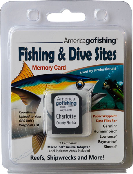
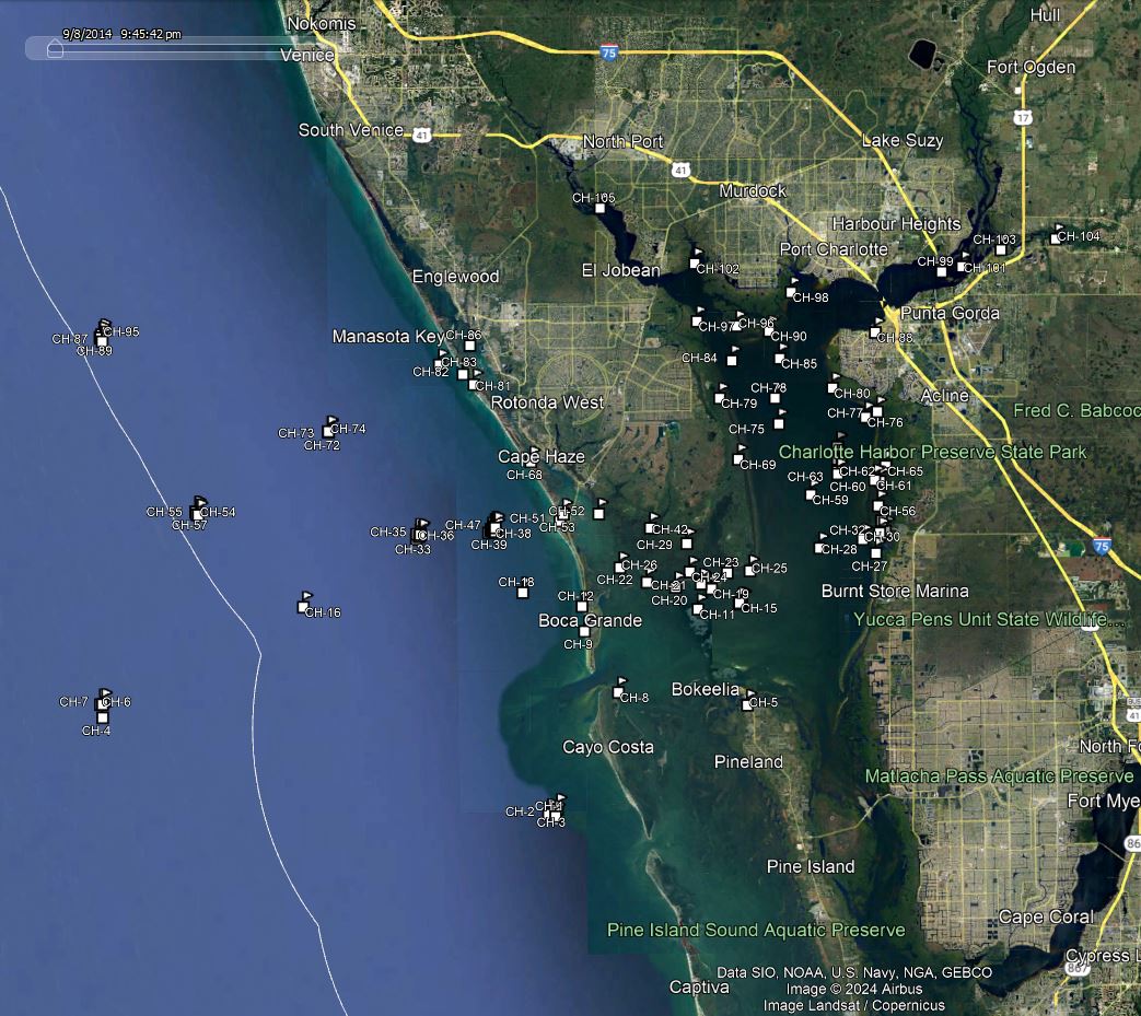
Click the Fishing & Dive Sites memory card image above to purchase Charlotte County reef sites on a chip. The map below shows the reef site locations included and how they will look on your GPS unit. The site names, materials and rules are located inside the waypoint's description field. Visit Waypoints on GPS Units for more information.

| Site ID / Reef Name | Material / Description |
|---|---|
| CH-1 Helens Barges 5 | 60' Barge Steel - 2 Barges |
| CH-2 Helens Reef | Culverts power poles rubble |
| CH-3 Boca Grande Reef | 667 Yards of Concrete Pilings and Rubble |
| CH-4 Box Car 5 | Steel Framework |
| CH-5 Shell Pass Inlet | GPS Waypoint from Charlotte Harbor in Bokeelia |
| CH-6 Box Car 7 | 8 Railroad Hopper Cars |
| CH-7 Box Car 1 | Railroad Boxcars Hopper Cars |
| CH-8 Boca Grande Channel | GPS Waypoint ICW - NW Cayo Costa island |
| CH-9 Old Phosphate Dock Gasparilla Is | 3 rows of old Dock Pilings protrude from water - approx |
| CH-10 Outlaw | Wreck |
| CH-11 Danger Reef | 40' Steel Tug on side no structure deteriorated |
| CH-12 17th Street Reefs Gasparilla Isl | Rock Ledges 100 yards from shore - appox |
| CH-13 Cape Haze B-3A | Modules Steel Units Concrete Culverts |
| CH-14 Cape Haze CULV1B | Concrete Culverts |
| CH-15 Cape Haze Reef (Bay) | 5 Culvert Bundles |
| CH-16 Charlottes Reef Slabs | Concrete Slabs |
| CH-17 Cape Haze 1A | Concrete Culverts |
| CH-18 Marys Reef | Concrete Culverts |
| CH-19 Gallaghers Cut | Entrance into Turtle Bay - trout snook redfish |
| CH-20 Bull Key | Island at entrance to Charlotte Harbor W |
| CH-21 Gallagher Keys | Islands at entrance to Turtle Bay on Charlotte Harbor |
| CH-22 Cayo Pelau | Island at entrance to Charlotte Harbor W |
| CH-23 Cape Haze | Cape at entrance to Turtle Bay |
| CH-24 Eagle Nest | Island on SW Turtle Bay |
| CH-25 Cape Haze Bar | Long Shallow Bar on Charlotte Harbor outside Turtle Bay |
| CH-26 Sandfly Key | Island in Gasparilla Sound |
| CH-27 Crow Key | Island on Charlotte Harbor near Punta Gorda |
| CH-28 Pirate Harbor Hole | Natural Deep Holes in Charlotte Harbor - tarpon sharks |
| CH-29 The Cut Off | Channel GPS Waypoint |
| CH-30 Roberts Island Channel | Channel GPS Waypoint |
| CH-31 Tremblay TR1 | Concrete Bridge Sections |
| CH-32 Terrapin Key | Island on Charlotte Harbor near Punta Gorda |
| CH-33 Tremblay Reef Center | Concrete Bridge Rubble - reef center |
| CH-34 Cotton Key | Island on Charlotte Harbor near Punta Gorda |
| CH-35 Tremblay Reef Barge | 90'x23'x8' Steel Deck Barge |
| CH-36 Tremblay TR2 | Coral Creek Bridge Sections |
| CH-37 Novak NR7 | Concrete Bridge Sections |
| CH-38 Novak NRMB | Matlacha Bridge Sections |
| CH-39 Novak Reef 04-Buoy 1a | Concrete Culverts |
| CH-40 Novak Memorial | Memorial Reef |
| CH-41 Novak Reef 1 Center | Concrete Bridge Rubble - reef center |
| CH-42 Mound Key | Island E Gasparilla Sound |
| CH-43 Novak Reef 2 | Concrete Bridge Rubble |
| CH-44 Novak Reef 3 | Concrete Bridge Rubble |
| CH-45 Novak Reef 4 | Concrete Bridge Rubble |
| CH-46 Novak Reef 04-Buoy 3a | Concrete Culverts |
| CH-47 Novak Reef 04-Buoy 3b | Concrete Culverts |
| CH-48 Novak Reef 04-Buoy 1b | Concrete Culverts |
| CH-49 Novak Reef 04-Buoy 1c | Concrete Culverts |
| CH-50 Fines Key | Island on Charlotte Harbor near Punta Gorda |
| CH-51 Gasparilla Pass | Channel GPS Waypoint |
| CH-52 Catfish Point | Cape on Gasparilla Sound Placida |
| CH-53 Bird Key 1 | Island on Placida Harbor and Boca Grande Pass |
| CH-54 Palm Island Barge Reef | 70'x23'x8' Steel Barge Concrete 1'x40' Steel Spuds |
| CH-55 Palm Island Ferry Reef | 60'x20'x5' Steel Car Ferry Concr Boxes Pilings |
| CH-56 Redfish Key | Island on Charlotte Harbor E |
| CH-57 Palm Island Ferry TR2 | Culverts |
| CH-58 Palm Island Ferry TR1 | Concrete Culverts, Limestone, Seawall Slabs |
| CH-59 Middle Harbor Hole | Natural Deep Holes in Charlotte Harbor - tarpon sharks |
| CH-60 Blacks Island | Island on Charlotte Harbor E |
| CH-61 Cormorant Key | Island on Charlotte Harbor E |
| CH-62 Charlotte Harbor Reef (Bay) | 1100 tons of Bridge Rubble Beams |
| CH-63 Charlotte Harbor Site (Bay) | Concrete Rubble |
| CH-64 Charlotte Harbour 1 (Bay) | Concrete Culverts |
| CH-65 Silcox Key | Island on Charlotte Harbor E |
| CH-66 Charlotte Harbor Site B (Bay) 3 | 17 Pallet and 35 Bay Balls East Row |
| CH-67 Charlotte Harbor Site A (Bay) 1 | 18 Pallet and 35 Bay Balls West Row |
| CH-68 Kettle Harbor | Bay off Cape Haze |
| CH-69 Blow Down Creek | Shallow Creek - winter Redfish summer snook |
| CH-70 Charlotte Harbor Site B (Bay) 4 | 17 Pallet and 35 Bay Balls East Row |
| CH-71 Charlotte Harbor Site A (Bay) 2 | 18 Pallet and 35 Bay Balls West Row |
| CH-72 Stump Pass 3 Mile 1 | Concrete Culverts |
| CH-73 Stump Pass 3 Mile 2 | Concrete Culverts |
| CH-74 Stump Pass 3 Mile 3 | Concrete Culverts |
| CH-75 Deep Hole 20 | Natural Deep Holes in Charlotte Harbor - tarpon sharks |
| CH-76 Charlotte Park | Channel GPS Waypoint |
| CH-77 Alligator Creek | Dredged Creek empties into Charlotte Harbor - winter snook |
| CH-78 Queen B V | 34' Chris-Craft Wooden Boat |
| CH-79 Oyster Creek | Shallow entrance to this Creek good fishing at mouth |
| CH-80 Barge Canal | Shallow Canal - lots of fish year round |
| CH-81 Stump Pass Inlet | Channel GPS Waypoint |
| CH-82 Peterson Island | Island at Stump Pass in state park |
| CH-83 Englewood Fish Haven | Bridge Rubble |
| CH-84 Deep Hole 14 | Hole 200 yards NW of Marker 8 - good fishing |
| CH-85 Old Tire Reef | Tires - no vertical profile remains |
| CH-86 Cedar Point | Cape across from Manasota Key Englewood |
| CH-87 Captain Jeff Steele Reef 09-1 | 279 tons of Concrete Culverts and Pilings |
| CH-88 Fisherman Village Yacht Basin | GPS Waypoint |
| CH-89 Captain Jeff Steele Reef N-1 | 144.7 tons of Culverts |
| CH-90 Locus Point | Cape at entrance to Myakka Cutoff |
| CH-91 Captain Jeff Steele Reef N-2 | 81.4 tons of Culverts |
| CH-92 Captain Jeff Steele Reef N-4 | 119.6 tons of Culverts |
| CH-93 Captain Jeff Steele Reef N-3 | 137.9 tons of Culverts |
| CH-94 Captain Jeff Steele Reef N-5 | 96.4 tons of Culverts |
| CH-95 Captain Jeff Steele Barge | 110' Steel Barge and Steele Memorial |
| CH-96 Hog Island | Island on Charlotte Harbor NW |
| CH-97 Cattle Dock Point | Point with cutoff Pilings west bank of Myakka River-Redfish |
| CH-98 Muddy Bay | Bay next to Cape Haze - snook redfish |
| CH-99 Bird Key 2 | Island on Charlotte Harbor N of bridge |
| CH-100 EL Cottingham | 523 ton Schooner |
| CH-101 Long Island | Island on Charlotte Harbor N of bridge |
| CH-102 Tippecanoe Bay | Shallow Bay for winter snook redfish |
| CH-103 Sans Souci Trestle | Trestle built 1907 on Shell Creek - good fishing underneath |
| CH-104 Shell Creek Dam | Dam on Shell Creek with submerged rock shallow |
| CH-105 Rock Creek | Creek to fish during high tide |


